
Ireland Braces for the Most Powerful Storm in Recorded History..
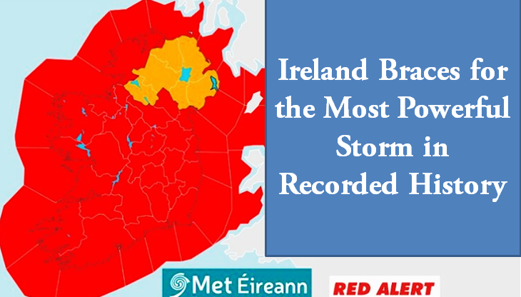
Dublin: Ireland is preparing for what is expected to be the most powerful storm in its history, with the chairman of the National Emergency Coordination Group, Keith Leonard, warning of its potentially catastrophic impact. Describing it as “one of the most severe storms the country has ever faced,” Leonard urged the public to take the threat seriously.
The Irish Meteorological Office (Met Éireann) has issued warnings about the storm’s potentially life-threatening nature, emphasising its capacity to cause widespread destruction. Comparisons have been drawn to Storm Ophelia in 2017, which left 385,000 customers without power. Storm Eowyn, however, is expected to inflict even greater damage, including risks of coastal flooding, severe waves, and destruction in low-lying areas.
“Stay Back, Stay High, Stay Dry”
The Irish Coast Guard reiterated its safety appeal, urging people to avoid coastal areas during the storm. Met Éireann highlighted the dangers of travelling or working outdoors, as well as potential disruptions to power, communications, and transport networks. A Status Red Alert, the highest warning level, has been issued as Storm Eowyn is forecast to bring extremely severe conditions.
Nationwide Warnings and Timelines
The storm will begin to impact the country from midnight tonight, with the worst conditions expected from early Friday morning until late evening. Authorities are advising residents across Ireland to stay at home and avoid unnecessary travel.
Specific Warnings
- Red Weather Alerts:
- Carlow, Kilkenny, Waterford, Cork, Kerry, Limerick: From 2 a.m. to 10 a.m. on Friday.
- Clare, Galway, Leitrim, Mayo, Sligo: From 3 a.m. to 10 a.m. on Friday.
- Cavan, Monaghan, Dublin, Kildare, Laois, Longford, Louth, Meath, Offaly, Westmeath, Wicklow, Roscommon, Tipperary: From 6 a.m. to 12 p.m. on Friday.
- Donegal: From 6 a.m. to 3 p.m. on Friday.
- Yellow Weather Alerts:
- Heavy rain warnings for Cork, Kerry, and Waterford from 9 p.m. tonight until 3 a.m. Friday.
Impact and Preparedness
The National Emergency Coordination Group has warned of severe traffic and power disruptions, falling trees, and widespread debris. Schools have been instructed to close, and businesses are advised to allow employees to work from home where possible. Those already at work before the storm should remain indoors until the alert period ends.
Keith Leonard noted that clean-up efforts following the storm will be extensive. Local authorities, the ESB, and civil defence teams have mobilised in preparation. Residents are urged to remain in higher ground areas and avoid the coastline during the warning period.
Northern Ireland Warnings
The UK Met Office has issued an Amber Wind Alert for Northern Ireland from midnight Friday to midnight Saturday, cautioning about strong winds capable of damaging buildings and downing power lines. A Yellow Wind Alert remains in effect until midnight Saturday.
Storm Eowyn: Fifth Storm of the Season
Storm Eowyn is the fifth named storm of the 2024-2025 season. Named jointly by Met Éireann, the UK Met Office, and the Netherlands’ KNMI, the season has already seen significant storm activity. Although January storms are relatively rare, six have been named in the past nine years, including three last January: Henk, Isha, and Jocelyn.
Safety First
As Ireland braces for the full force of Storm Eowyn, authorities are urging the public to take every precaution. “This is a dangerous and potentially life-threatening storm,” Leonard warned, emphasising the importance of staying home, avoiding coastal areas, and adhering to all safety guidelines.
Irish Samachar English News
{OR} Kindly click to follow the Irish Samachar News channel on WhatsApp
Comments are closed.